

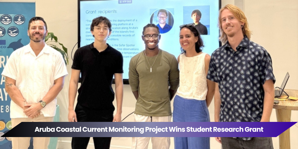
ORANJESTAD, Aruba — An Aruba Coastal Current Monitoring project developed by two University of Aruba students has received an Afl. 20,000 grant to begin collecting publicly accessible oceanographic data around the island.
Iberostar Aruba awarded its Bright Future Research Grant to Kieran Kelly and Stephen Richards through the company’s Aula di Lama initiative.
Kelly and Richards are SISSTEM students completing bachelor’s studies in Bio-Environmental Science at the University of Aruba. Their winning proposal, Coastal Current Monitoring in Aruba, was selected following an evaluation of environmental research projects.

Project Addresses Gap in Coastal Data
The students’ proposal seeks to address a shortage of detailed information about currents close to Aruba’s shoreline.
Existing regional ocean models provide valuable information about movement across large marine areas. However, their spatial resolution may be too broad to accurately represent the smaller and rapidly changing coastal conditions surrounding an island such as Aruba.
HYCOM’s global ocean-analysis system uses approximately one-twelfth-degree resolution, representing about seven kilometres of average spacing. Local measurements could therefore complement the regional model with observations taken directly from Aruba’s coastal environment.
First Buoy Expected Within Six Months
The project team plans to deploy its first coastal-monitoring buoy within the next six months.
The buoy is expected to measure the direction and speed of ocean currents and transmit information in near real time to a publicly accessible platform.
According to the project announcement, the platform will be developed with Brenchie’s Lab, part of Metabolic Foundation. Metabolic Foundation is based in Aruba and focuses on community-led development, open-source solutions and environmental innovation.
No exact deployment location, equipment model or installation date was disclosed.
Data Will Be Open to the Public
The initiative is designed as an open-source, continuing monitoring project rather than a short-term research exercise with privately held results.
Researchers, environmental organisations, government departments, coastal managers and members of the public are expected to have access to the measurements through the planned online platform.
Making the data openly available could allow different organisations to analyse the same information, compare changes over time and use the results when developing environmental projects or coastal-management policies.
The project would establish Aruba’s first centralised, open-data tracker dedicated specifically to coastal currents once the initial buoy and public platform become operational.
Network Could Expand Around Aruba
Kelly and Richards envision the first buoy as the beginning of a wider coastal-monitoring network.
Additional equipment could eventually be placed at several locations around Aruba, creating a more complete picture of how currents vary between different sides of the island and during different seasons.
Expanding the system would require additional financing, equipment, permits, technical support and long-term maintenance. The announcement does not confirm funding for more than the initial stage.
Research Could Support Sargassum Monitoring
One potential use for the data is improving the understanding of how floating sargassum moves near Aruba’s coastline.
Current models are already used with satellite observations to estimate which Caribbean coastal areas may face sargassum inundation. Locally collected current measurements could help researchers assess how regional forecasts correspond with conditions closer to Aruba’s shore.
The information could eventually support planning by environmental organisations, tourism operators and cleanup teams. However, the project has not yet demonstrated that it can predict when or where sargassum will arrive.
Coastal Safety Among Potential Applications
The students also identified dangerous coastal conditions, including strong rip currents, as a possible area of study.
Rip currents are concentrated flows of water moving from the shoreline toward deeper water. Their formation can depend on waves, winds, sandbars, reefs and the shape of the coast.
Measurements from a suitably placed buoy could contribute useful information about surrounding water movement. However, public warnings would require broader scientific analysis and should not rely on a single monitoring station.
Selection Panel Evaluated Long-Term Value
The winning proposal was selected by a panel involving three University of Aruba professors and representatives of Metabolic Foundation, Iberostar Aruba, Fundación Iberostar and Wave of Change.
Projects were evaluated on factors including:
- Their ability to address missing environmental data;
- Technical feasibility;
- Potential to expand;
- Use of local knowledge and infrastructure;
- Long-term continuity;
- Environmental impact;
- Contribution to understanding Aruba’s coastline.
The organisers said all submitted proposals demonstrated scientific merit, but the coastal-current project stood out because it introduced a monitoring approach not previously implemented on the island.
Grant Focuses on Lasting Monitoring Systems
The Bright Future Research Grant was established to support practical environmental-monitoring initiatives capable of producing reliable and publicly accessible information.
Rather than financing only a traditional research project addressing one predetermined question, the grant supports infrastructure that can continue generating data for future studies.
Iberostar has previously supported research and conservation programmes involving marine ecosystems, coral reefs and coastal environments through its wider sustainability initiatives.
Students Contribute to Aruba’s Marine Future
The grant gives Kelly and Richards an opportunity to apply their scientific studies to a project with potential long-term value for Aruba.
Once deployed, the Aruba Coastal Current Monitoring buoy could begin filling an important information gap while creating a foundation for future research involving marine ecosystems, coastal resilience and environmental planning.
The project remains in its development stage, but its open-data approach could allow knowledge generated by the students to continue benefiting researchers, policymakers and the wider community after their university studies are completed.